Turning a technically sound GIS program into a structured, engaging digital learning experience for engineering professionals.

THE OVERVIEW:
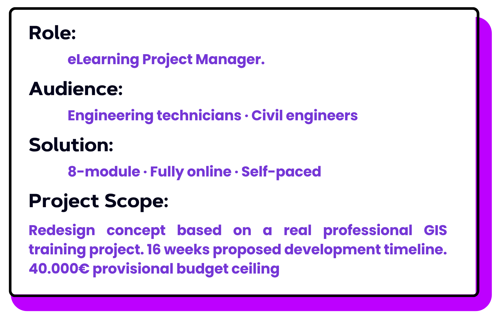
This project involved managing the redesign of an existing professional GIS program that had transitioned from classroom delivery to an online environment. While the SME-approved technical curriculum remained relevant, the project required a more structured approach to learner progression, practical application, stakeholder coordination, delivery planning, and quality assurance.
The redesign focused on improving how learners experienced, practiced, and progressed through the program while translating the solution into a coordinated 16-week eLearning development plan.
⭐THE CHALLENGE:
The existing GIS program had been designed for classroom delivery and later moved online. Although the technical curriculum remained relevant and SME-approved, the digital experience did not provide the same level of guidance, interaction, or visible progression.
As technical complexity increased, learner engagement declined, with a significant rise in dropout between Modules 2 and 3. The redesign therefore needed to improve learner progression, practical application, and workplace relevance while preserving the complete technical curriculum.
.
Key learner needs
• Structured guidance for technical skill development
• Greater opportunity for authentic GIS application
• Support for different experience levels
• Reduced technical friction
Project constraints
• Fixed SME-approved curriculum
• 16-week delivery timeline
• €40K provisional budget ceiling
• Moodle and QGIS as mandatory infrastructure
THE SOLUTION:
From Classroom-Based Training to a Structured Digital Learning Experience
The redesign preserved the SME-approved technical curriculum while restructuring how learners progressed, practiced, and demonstrated GIS skills. The solution combined a clearer competency pathway, authentic QGIS application, and visible progression throughout the experience.
Three Core Design Decisions
01 — Restructure the learning pathway
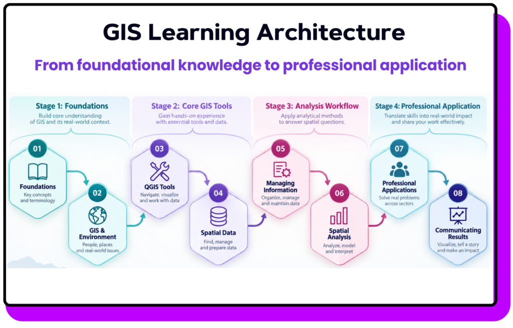
The original six modules were reorganized into eight competency-based stages, creating a clearer progression from foundational knowledge to professional application.
02 — Prioritize authentic QGIS practice
Guided demonstrations, real datasets, and engineering scenarios shifted the experience from passive content consumption toward workplace application.
03 — Make progression visible
A Progressive Motivation Design framework reinforced achievement through practice, feedback, competency milestones, and module progression.
Explore → Learn → Practice → Feedback → Demonstrate → Progress
THE PROCESS:
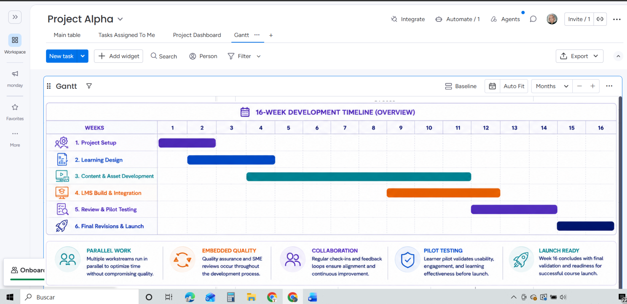
Planning the Work: A 16-Week Phased Delivery Plan
The project was structured across six partially overlapping phases, allowing design, development, integration, and quality assurance activities to progress in parallel.
Coordinating People and Decisions
This project required coordination across business, technical, learning, development, QA, and learner stakeholders. I mapped each stakeholder by influence, responsibilities, dependencies, and required communication.
→ Project Sponsor: Milestone approvals, resource decisions, escalated risks
→ GIS SME: Technical validation and content approval
→ Development Team: Approved specifications, priorities, revisions, dependencies
→ QA Reviewer: Quality standards, identified issues, corrections, sign-off.
Stakeholder responsibilities, approval points, communication needs, and escalation paths were defined early so that technical, learning, and production decisions could move through the project without creating avoidable rework.
Managing Risk
The risk assessment identified ten project uncertainties. Ten project risks were identified and assessed by likelihood, impact, ownership, mitigation, and trigger.
Likelihood → Impact → Preventive Action → Response → Owner → Trigger
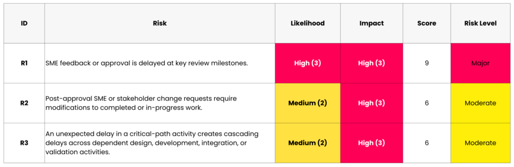
10 risks assessed across: Schedule · Scope · Resources · Technology · QA · Pilot participation
THE RESULT:
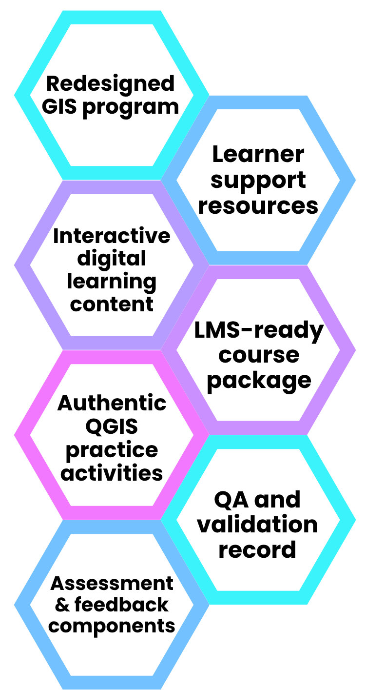
From Redesign Strategy to Launch-Ready Learning Solution. The project produced a structured eight-module digital GIS learning experience supported by a defined delivery roadmap, stakeholder governance, quality assurance process, and post-launch measurement framework.
Post-launch evaluation would track:
Completion and dropout · Practical task performance · Usability and accessibility · Workplace application
MY TAKEAWAYS:
This project changed the way I think about digital learning projects. I learned that strong learning design is only one part of the work; the quality of the final experience also depends on how well scope, stakeholders, risks, approvals, and delivery decisions are managed.It also reinforced the way I prefer to work: connecting learning decisions with project decisions from the beginning, rather than treating design and delivery as separate processes.
What I would carry forward:
Design for learning quality, manage for delivery quality, and treat both as part of the same system.